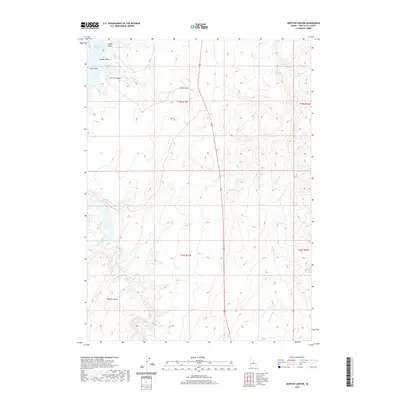
2020 Map of Norton Canyon
USGS Topo · Published 2020About this map
Salmon Falls Creek Reservoir dominates the northwestern corner of this Twin Falls County landscape, where the water reaches into Nortons Bay and skirts several prominent landmarks including Saddle Point, Crappie Point, and Luds Point. The terrain is defined by the sharp descent of Norton Canyon and the expansive elevated plateau of Browns Bench to the southwest. This area is a critical water source in the high desert, evidenced by the numerous isolated water points such as Threemile Spring, Rabbit Spring, and Sand Spring. Drainage patterns across the eastern half are dictated by Twin Springs Cr, which flows near the locality of Twin Springs. The road network is sparse, with Norton Bay Rd providing one of the few primary access routes through the breaks above the reservoir.
Find a feature on this map
18 named features on this map. Tap any name to fly to it.
Don’t see what you’re looking for? This feature index may not catch every label — zoom into the map to look around manually.
Map Details
Editions of this 2020 Norton Canyon Map
This is the sole edition of this map. No revisions or reprints were ever made.
Other maps of this area

1955 · Twin Falls
USGS Topo · 1:250,000

1955 · Wells
USGS Topo · 1:250,000

1957 · Contact
USGS Topo · 1:62,500

1957 · Delaplain
USGS Topo · 1:62,500

1958 · Wells
USGS Topo · 1:250,000

1958 · Twin Falls
USGS Topo · 1:250,000

1961 · Wells
USGS Topo · 1:250,000

1977 · Browns Bench South
USGS Topo · 1:24,000

1977 · Rogerson
USGS Topo · 1:24,000

1977 · Magic Hot Springs
USGS Topo · 1:24,000