Loading...
Loading map...2023 Map of Notus
USGS Topo · Published 2023About this map
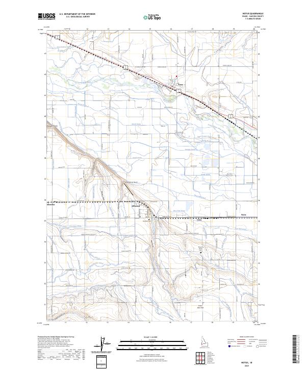
The Boise River carves through this agricultural landscape between Notus and Greenleaf, anchoring an intricate network of irrigation that has defined Canyon County farming for generations. The map reveals the heavy reliance on water engineering, with the Farmers Cooperative Sebree Canal and Riverside Canal managing the flow across the valley floor. To the south, the terrain rises toward the ridges, where the Deer Flat High Line Canal and Phyllis Canal follow the contours of the land.
Find a feature on this map
111 named features on this map. Tap any name to fly to it.
Don’t see what you’re looking for? This feature index may not catch every label — zoom into the map to look around manually.
Map Details
Date Portrayed2023
Date Published2023
PublisherU.S. Geological Survey
Map TypeTopographic
Scale1:24000
Physical Dimensions24 x 29 inches
Editions of this 2023 Notus Map
This is the sole edition of this map. No revisions or reprints were ever made.
Historical Maps of Notus Through Time
Featured Locations
Source Details
SourceU.S. Geological Survey
CopyrightPublic Domain