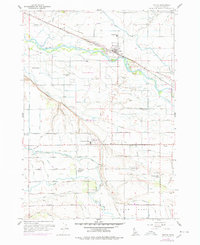
1957 Map of Notus
USGS Topo · Published 1978About this map
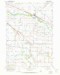
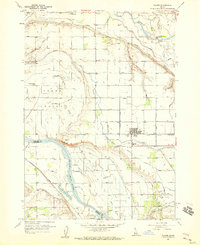
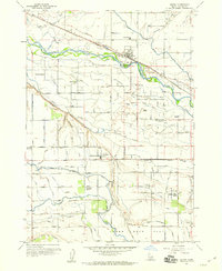
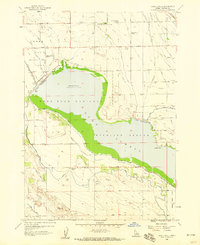
The Boise River valley defines this irrigation-rich landscape, where the Union Pacific (Oregon Short Line) railroad links the agricultural hubs of Notus and Greenleaf. This 1950s survey reveals an intensive network of water management features, including the Sebree Canal, Dotson Canal, and Renshaw Pipe Line, which transformed the arid soils of Lower Deer Flat into productive farmland.
Find a feature on this map
46 named features on this map. Tap any name to fly to it.
Don’t see what you’re looking for? This feature index may not catch every label — zoom into the map to look around manually.
Map Details
Editions of this 1957 Notus Map
3 editions found
Other maps of this area

1898 · Nampa
USGS Topo · 1:125,000

1955 · Boise
USGS Topo · 1:250,000
1957 · Wilder
USGS Topo · 1:24,000
1957 · Notus
USGS Topo · 1:24,000

1958 · Boise
USGS Topo · 1:250,000
1958 · Lake Lowell
USGS Topo · 1:24,000
1958 · Caldwell
USGS Topo · 1:24,000
1958 · Homedale
USGS Topo · 1:24,000
1958 · Marsing
USGS Topo · 1:24,000

1962 · Boise
USGS Topo · 1:250,000