
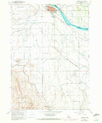
1958 Map of Homedale
USGS Topo · Published 1960About this map
Homedale serves as the focal point for this late 1950s survey of the Idaho-Oregon borderlands, where the Snake River carves through the landscape of Canyon and Owyhee counties. The agricultural irrigation network is highly developed, featuring complex systems like the Deer Low Line Canal, Murray Ditch, and Spoil Bank Canal Drain. These watercourses supported local industry and the Labor Camp south of town. To the south, the terrain rises toward the Owyhee Mountains, passing distinctive landmarks like Rattlesnake Butte and Flat Top Butte. Traces of the region's transportation history are visible at the Poison Creek Stage Sta and along the Union Pacific rail line, which borders Rabbit Island as it follows the river's bend. The map also captures essential civic structures, including the Marsing-Homedale Cemetery and the local High Sch.
Find a feature on this map
52 named features on this map. Tap any name to fly to it.
Don’t see what you’re looking for? This feature index may not catch every label — zoom into the map to look around manually.
Map Details
Editions of this 1958 Homedale Map
2 editions found
Other maps of this area

1892 · Silver City
USGS Topo · 1:125,000

1894 · Silver City
USGS Topo · 1:125,000

1898 · Nampa
USGS Topo · 1:125,000

1898 · Silver City
USGS Topo · 1:125,000

1906 · Mitchell Butte
USGS Topo · 1:125,000

1955 · Boise
USGS Topo · 1:250,000

1957 · Opalene Gulch
USGS Topo · 1:24,000

1957 · Wilder
USGS Topo · 1:24,000

1957 · Sands Basin
USGS Topo · 1:62,500

1957 · Notus
USGS Topo · 1:24,000