
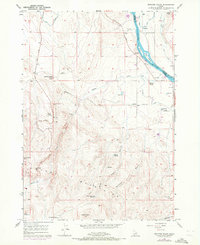
1957 Map of Opalene Gulch
USGS Topo · Published 1958About this map
The Owyhee Mountains and the Snake River define the terrain of this mid-century Idaho survey, where water management is central to the landscape. To the north, the river winds around Fruit Island and Dilley Island near the settlement of Riverside, supporting a complex irrigation network including the South Canal, the Flat Low Line Canal, and various flumes and siphons. Local landmarks like the Opalene School and a Boy Scout Camp indicate the social hubs of this rural corridor during the late 1950s.
Find a feature on this map
48 named features on this map. Tap any name to fly to it.
Don’t see what you’re looking for? This feature index may not catch every label — zoom into the map to look around manually.
Map Details
Editions of this 1957 Opalene Gulch Map
2 editions found
Other maps of this area

1892 · Silver City
USGS Topo · 1:125,000

1894 · Silver City
USGS Topo · 1:125,000

1898 · Nampa
USGS Topo · 1:125,000

1898 · Silver City
USGS Topo · 1:125,000

1955 · Boise
USGS Topo · 1:250,000

1957 · Wilson Peak
USGS Topo · 1:24,000

1957 · Sands Basin
USGS Topo · 1:62,500

1958 · Boise
USGS Topo · 1:250,000
1958 · Givens Hot Springs
USGS Topo · 1:24,000
1958 · Lake Lowell
USGS Topo · 1:24,000