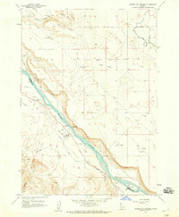
1958 Map of Givens Hot Springs
USGS Topo · Published 1959About this map
Givens Hot Springs and the surrounding irrigation network along the Snake River define this Idaho landscape at the end of the 1950s. The map documents a transition in river crossings, marking the locations for the Bernard Ferry (Site) and Hot Springs Ferry (Site) while the Owyhee Highway serves as the primary modern thoroughfare. Cultural history is etched into the terrain at Map Rock (Petroglyphs), overlooking Rippee Island and Ware Island.
Find a feature on this map
35 named features on this map. Tap any name to fly to it.
Don’t see what you’re looking for? This feature index may not catch every label — zoom into the map to look around manually.
Map Details
Editions of this 1958 Givens Hot Springs Map
2 editions found
Other maps of this area

1892 · Silver City
USGS Topo · 1:125,000

1894 · Silver City
USGS Topo · 1:125,000

1898 · Nampa
USGS Topo · 1:125,000

1898 · Silver City
USGS Topo · 1:125,000

1955 · Boise
USGS Topo · 1:250,000
1957 · Walters Butte
USGS Topo · 1:24,000

1957 · Opalene Gulch
USGS Topo · 1:24,000

1957 · Wilson Peak
USGS Topo · 1:24,000

1957 · Sands Basin
USGS Topo · 1:62,500

1958 · Boise
USGS Topo · 1:250,000