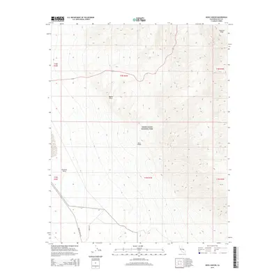
2015 Map of Nova Canyon
USGS Topo · Published 2015About this map
The Panamint Range rises sharply above the Mojave Desert floor, defining the arid landscape of this 2015 topographic survey. Much of the terrain is protected within the southwestern boundary of Death Valley National Park, where the namesake Nova Canyon cuts through complex geological formations. Human infrastructure is sparse, limited to narrow transit corridors that navigate the alluvial fans and steep slopes. Panamint Valley Rd and Minietta Rd skirt the western edge of the mountains, providing critical access points into the park's interior. This map captures the stark environmental contrast between the high mountain ridgelines and the low-lying basins that characterize this section of Inyo County.
Find a feature on this map
13 named features on this map. Tap any name to fly to it.
Don’t see what you’re looking for? This feature index may not catch every label — zoom into the map to look around manually.
Map Details
Editions of this 2015 Nova Canyon Map
This is the sole edition of this map. No revisions or reprints were ever made.
Other maps of this area

1908 · Ballarat
USGS Topo · 1:250,000

1913 · Ballarat
USGS Topo · 1:250,000

1948 · Death Valley
USGS Topo · 1:250,000

1951 · Panamint Butte
USGS Topo · 1:62,500

1951 · Maturango Peak
USGS Topo · 1:62,500

1952 · Telescope Peak
USGS Topo · 1:62,500

1952 · Emigrant Canyon
USGS Topo · 1:62,500

1954 · Death Valley
USGS Topo · 1:250,000

1956 · Death Valley
USGS Topo · 1:250,000

1957 · Death Valley
USGS Topo · 1:250,000