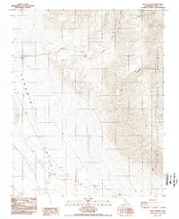
1986 Map of Nova Canyon
USGS Topo · Published 1986About this map
The dramatic transition from high ridge lines to the desert floor defines this mid-1980s topographic study of the Panamint Valley. The eastern portion of the map is dominated by the boundary of the Death Valley National Monument, where steep, carved drainages such as Nova Canyon descend into the arid basin. This landscape reflects the complex tectonic and alluvial history of Inyo County, showing a desert floor marked by numerous benchmark elevations and sparse infrastructure. State Route 190 provides the primary corridor through this desert terrain, following the natural contours of the northern valley edge. The presence of Dolomite Can in the north suggests the localized geological focus of the era's surveyors, capturing a moment when much of this territory remained under federal management as a National Monument before later status changes.
Find a feature on this map
9 named features on this map. Tap any name to fly to it.
Don’t see what you’re looking for? This feature index may not catch every label — zoom into the map to look around manually.
Map Details
Editions of this 1986 Nova Canyon Map
This is the sole edition of this map. No revisions or reprints were ever made.
Other maps of this area

1908 · Ballarat
USGS Topo · 1:250,000

1913 · Ballarat
USGS Topo · 1:250,000

1948 · Death Valley
USGS Topo · 1:250,000

1951 · Panamint Butte
USGS Topo · 1:62,500

1951 · Maturango Peak
USGS Topo · 1:62,500

1952 · Telescope Peak
USGS Topo · 1:62,500

1952 · Emigrant Canyon
USGS Topo · 1:62,500

1954 · Death Valley
USGS Topo · 1:250,000

1956 · Death Valley
USGS Topo · 1:250,000

1957 · Death Valley
USGS Topo · 1:250,000