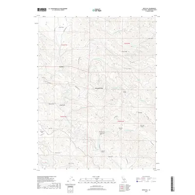
2018 Map of Noyo Hill
USGS Topo · Published 2018About this map
Glenblair sits in the northwest of this Mendocino County landscape, where the headwaters of Pudding Cr and Little Valley Cr begin their descent toward the coast. The terrain is defined by a dense network of watercourses and ridges, including Ramsey Ridge and Riley Ridge, which separate the various forks of the Noyo River. Small clusters of activity at Redwood Lodge and Grove reflect the area's ongoing connection to timber and transit along the winding Fort Bragg-Sherwood Rd.
Find a feature on this map
45 named features on this map. Tap any name to fly to it.
Don’t see what you’re looking for? This feature index may not catch every label — zoom into the map to look around manually.
Map Details
Editions of this 2018 Noyo Hill Map
This is the sole edition of this map. No revisions or reprints were ever made.
Other maps of this area

1920 · Glenblair
USGS Topo · 1:62,500

1920 · Fort Bragg
USGS Topo · 1:62,500

1921 · Westport
USGS Topo · 1:62,500

1921 · Branscomb
USGS Topo · 1:62,500

1943 · Glenblair
USGS Topo · 1:62,500

1943 · Fort Bragg
USGS Topo · 1:62,500

1950 · Cape Vizcaino
USGS Topo · 1:62,500

1951 · Cape Vizcaino
USGS Topo · 1:62,500

1951 · Branscomb
USGS Topo · 1:62,500

1957 · Ukiah
USGS Topo · 1:250,000