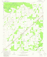
1965 Map of O'Kean
USGS Topo · Published 1981About this map
The confluence of the Current River and the Black River dominates the northern reaches of this mid-century Arkansas landscape. Set along the Missouri Pacific railroad line, the town of O'Kean serves as a central hub for the surrounding agricultural and swampy bottomlands. The map reveals an intricate network of drainage systems such as Conley Ditch and Big Slough, essential for managing the water-rich terrain of the Black River State Game Area.
Find a feature on this map
32 named features on this map. Tap any name to fly to it.
Don’t see what you’re looking for? This feature index may not catch every label — zoom into the map to look around manually.
Map Details
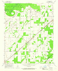
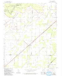
Editions of this 1965 O'Kean Map
3 editions found
Other maps of this area

1932 · Walnut Ridge
USGS Topo · 1:62,500

1935 · Knobel
USGS Topo · 1:62,500

1935 · Reyno
USGS Topo · 1:62,500

1935 · Walnut Ridge
USGS Topo · 1:62,500

1940 · Gainesville
USGS Topo · 1:62,500

1941 · Knobel
USGS Topo · 1:62,500

1957 · Poplar Bluff
USGS Topo · 1:250,000

1958 · Gainesville
USGS Topo · 1:62,500

1959 · Poplar Bluff
USGS Topo · 1:250,000
1960 · Gainesville
USGS Topo · 1:62,500