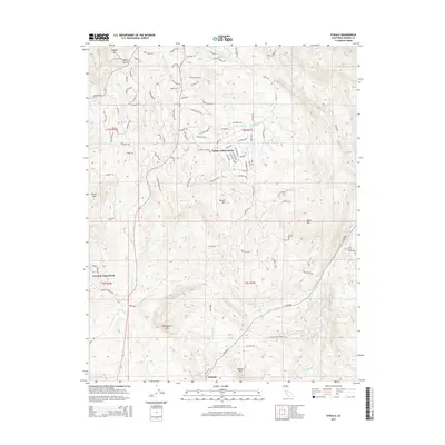
2015 Map of O'Neals
USGS Topo · Published 2015About this map
Indian Lakes Estates and Yosemite Lakes Park anchor this portion of the Sierra Nevada foothills, showcasing a landscape defined by residential development intersecting with traditional creek drainages. The area is characterized by a series of prominent peaks, including Quartz Mtn, Blackhawk Mtn, and Mercer Mtn, which overlook the complex network of waterways that flow through the territory. The presence of both the Picayune Cemetery and Fine Gold Cemetery provides specific points of interest for genealogists tracing local families in Madera County. The drainage patterns of Coarse Gold Cr and Picayune Cr are clearly mapped alongside Fine Gold Cr, illustrating the watershed's influence on early settlement and modern road placement. At the southern edge, the community of O'Neals marks a transition point in the local geography near Willow Cr.
Find a feature on this map
126 named features on this map. Tap any name to fly to it.
Don’t see what you’re looking for? This feature index may not catch every label — zoom into the map to look around manually.
Map Details
Editions of this 2015 O'Neals Map
This is the sole edition of this map. No revisions or reprints were ever made.
Other maps of this area

1912 · Mariposa
USGS Topo · 1:125,000

1916 · Sulphur Springs
USGS Topo · 1:24,000

1919 · Sulphur Springs
USGS Topo · 1:31,680

1919 · Little Table Mountain
USGS Topo · 1:31,680

1942 · Raymond
USGS Topo · 1:62,500

1942 · Little Table Mountain
USGS Topo · 1:24,000

1942 · Millerton Lake
USGS Topo · 1:62,500

1944 · Raymond
USGS Topo · 1:62,500

1945 · Millerton Lake
USGS Topo · 1:62,500

1947 · Mariposa
USGS Topo · 1:250,000