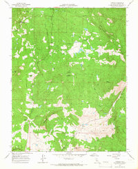
1965 Map of O'Neals
USGS Topo · Published 1966About this map
O'Neals and the surrounding Sierra Nevada foothills are captured in this mid-1960s survey, revealing a landscape defined by cattle ranching and early mining history. The map highlights several prominent family-named properties, including the 101 Ranch, Roedale Ranch, and Bigelow Ranch, which punctuate the terrain alongside the sprawling San Joaquin Experimental Range. This era shows the intersection of state land management and local life, evidenced by the California Youth Authority Camp near Trabuco Mountain and the Coarse Gold Fire Station.
Find a feature on this map
38 named features on this map. Tap any name to fly to it.
Don’t see what you’re looking for? This feature index may not catch every label — zoom into the map to look around manually.
Map Details
Editions of this 1965 O'Neals Map
2 editions found
Other maps of this area

1912 · Mariposa
USGS Topo · 1:125,000

1916 · Sulphur Springs
USGS Topo · 1:24,000

1919 · Sulphur Springs
USGS Topo · 1:31,680

1919 · Little Table Mountain
USGS Topo · 1:31,680

1942 · Raymond
USGS Topo · 1:62,500

1942 · Little Table Mountain
USGS Topo · 1:24,000

1942 · Millerton Lake
USGS Topo · 1:62,500

1944 · Raymond
USGS Topo · 1:62,500

1945 · Millerton Lake
USGS Topo · 1:62,500

1947 · Mariposa
USGS Topo · 1:250,000