Loading...
Loading map...2022 Map of Oakdale
USGS Topo · Published 2022About this map
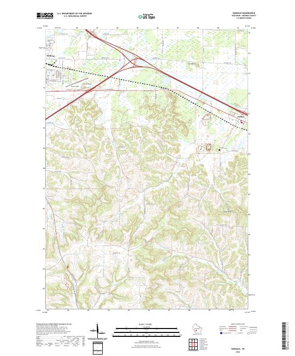
Tomah and Oakdale anchor this Monroe County landscape, where the flatlands of the north meet the more dissected topography of the south. The transition is marked by prominent landmarks like Stone Bluff and the curiously named Camels Hump, rising near Bloyer Field. The northern half of the region is defined by a dense network of roads, including W Badger Dr and Greyhound Ave, while the south shifts into the more dramatic terrain of Indian Ridge and Cold Spring Valley.
Find a feature on this map
47 named features on this map. Tap any name to fly to it.
Don’t see what you’re looking for? This feature index may not catch every label — zoom into the map to look around manually.
Map Details
Date Portrayed2022
Date Published2022
PublisherU.S. Geological Survey
Map TypeTopographic
Scale1:24000
Physical Dimensions24 x 29 inches
Editions of this 2022 Oakdale Map
This is the sole edition of this map. No revisions or reprints were ever made.
Historical Maps of Oakdale Through Time
Featured Locations
Source Details
SourceU.S. Geological Survey
CopyrightPublic Domain