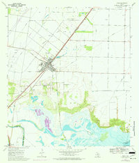
1969 Map of Odem
USGS Topo · Published 1977About this map
The Missouri Pacific railroad corridor dictates the layout of the coastal bend landscape in this late 1960s study, creating a central axis for the town of Odem. This area of San Patricio County is defined by its industrial and social hubs, including the Spartan Oil Field and the Odem Oil Field, which are crisscrossed by an extensive network of pipelines. Genealogists will find significant value in the detailed mapping of local burial sites, such as Evergreen Cem, Memorial Cem, and San Pedro Cem. The southern edge of the survey transitions from these developed uplands into the wetlands of the Nueces River and Rincon Bayou, where the Corpus Christi Filtration Plant sits near the head of Nueces Bay. The 1975 photorevisions, marked in purple, illustrate subtle changes in the marshlands and local infrastructure, such as the Sewage Disposal plant.
Find a feature on this map
23 named features on this map. Tap any name to fly to it.
Don’t see what you’re looking for? This feature index may not catch every label — zoom into the map to look around manually.
Map Details
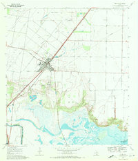
Editions of this 1969 Odem Map
2 editions found
Other maps of this area

1925 · Robstown
USGS Topo · 1:62,500

1925 · Corpus Christi
USGS Topo · 1:62,500

1950 · Corpus Christi
USGS Topo · 1:250,000

1951 · Corpus Christi
USGS Topo · 1:24,000

1951 · Corpus Christi
USGS Topo · 1:62,500

1953 · Beeville
USGS Topo · 1:250,000

1954 · Woodsboro
USGS Topo · 1:62,500

1954 · Robstown
USGS Topo · 1:62,500

1954 · Sinton
USGS Topo · 1:62,500

1956 · Corpus Christi
USGS Topo · 1:250,000
Featured Places
- Corpus Christi, TX
- Odem, TX
- Cheyene Colonia, TX
- Sunrise Acres Colonia, TX
- Friendswood Acres Number 2 Colonia, TX