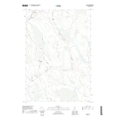
2018 Map of Olamon
USGS Topo · Published 2018About this map
Olamon and Cardville serve as the primary focal points of this Penobscot County landscape, situated east of the Penobscot River. The terrain is defined by the unique glacial geology of the Enfield Horseback, an esker ridge that influences the local drainage patterns. Water is central to this area's geography, with the branching network of Olamon Stream, Halfway Brook, and Sunkhaze Stream winding through extensive wetland areas. Local history and genealogy are anchored by several family-named burial grounds, including the Dennis Cem and Welles Cem near the northern settlement, and the Cardville Cem further south. A network of rural routes such as Main Rd and Cardville Rd connects these small communities, while the S Buzzy Brook Trail offers a route through the more wooded interior sections.
Find a feature on this map
43 named features on this map. Tap any name to fly to it.
Don’t see what you’re looking for? This feature index may not catch every label — zoom into the map to look around manually.
Map Details
Editions of this 2018 Olamon Map
This is the sole edition of this map. No revisions or reprints were ever made.
Other maps of this area

1902 · Orono
USGS Topo · 1:62,500

1917 · Passadumkeag
USGS Topo · 1:62,500

1929 · Great Pond
USGS Topo · 1:48,000

1931 · Saponac
USGS Topo · 1:48,000

1932 · Great Pond
USGS Topo · 1:62,500

1934 · Saponac
USGS Topo · 1:62,500

1944 · Orono
USGS Topo · 1:62,500

1946 · Orono
USGS Topo · 1:62,500

1948 · Bangor
USGS Topo · 1:250,000

1954 · Millinocket
USGS Topo · 1:250,000