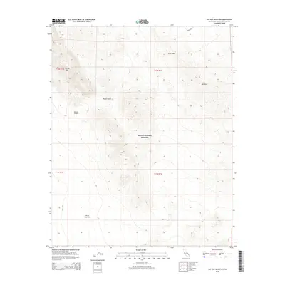
2015 Map of Old Dad Mountain
USGS Topo · Published 2015About this map
Mojave National Preserve encompasses most of this 2015 topographic study, documenting a landscape defined by dramatic elevation changes and arid landforms. The Old Dad Mtn peak and the spine of Rocky Ridge dominate the northern terrain, giving way to the erosive path of Jackass Canyon. This area illustrates the stark geological transition from the high ridges of the Kelso Mountains down into the expansive sands of the Devils Playground to the south. Human infrastructure is notably sparse in this protected desert wilderness, represented primarily by the utility corridor of Powerline Rd cutting across the northeast corner, leaving the vast majority of the Mojave Desert floor shown here in its natural state.
Find a feature on this map
12 named features on this map. Tap any name to fly to it.
Don’t see what you’re looking for? This feature index may not catch every label — zoom into the map to look around manually.
Map Details
Editions of this 2015 Old Dad Mountain Map
This is the sole edition of this map. No revisions or reprints were ever made.
Other maps of this area

1910 · Ivanpah
USGS Topo · 1:250,000

1912 · Ivanpah
USGS Topo · 1:250,000

1942 · Ivanpah
USGS Topo · 1:250,000

1942 · Amboy
USGS Topo · 1:250,000

1943 · Amboy
USGS Topo · 1:250,000

1947 · Kingman
USGS Topo · 1:250,000

1948 · Kingman
USGS Topo · 1:250,000

1954 · Needles
USGS Topo · 1:250,000

1954 · Kingman
USGS Topo · 1:250,000

1955 · Kingman
USGS Topo · 1:250,000