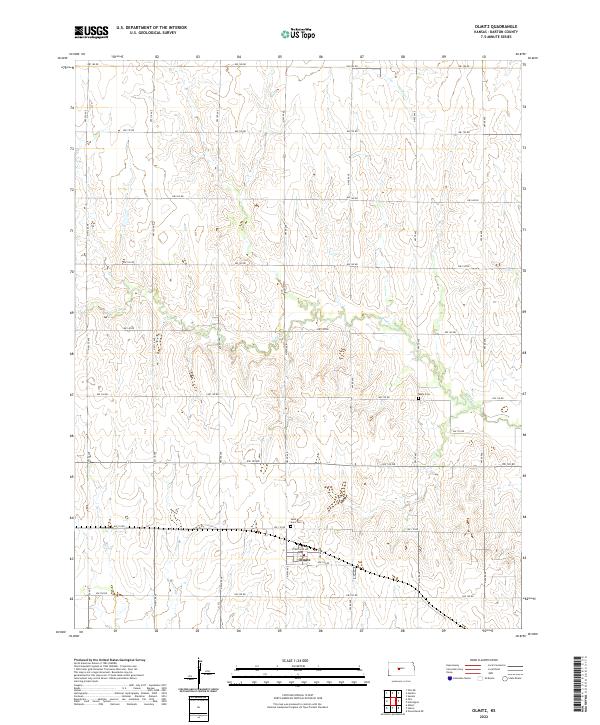
2022 Map of Olmitz
USGS Topo · Published 2022About this map
Olmitz serves as the central hub of this agricultural landscape in Barton County, where the grid-based road network of the Great Plains is interrupted only by the winding paths of Blood Cr and London Cr. The settlement is defined by a dense cluster of development around Cleveland Ave and NW 105 Rd, reflecting the concentrated nature of rural town centers in central Kansas. Outside the town limits, the map reveals the locations of early area burials at Boyle Cem and Saint Anns Cem, which provide essential touchpoints for genealogists tracing the legacy of the region's settlers. The surrounding terrain is meticulously divided by numbered avenues and roads, such as NW 120 Ave and NW 180 Rd, illustrating the enduring influence of the Public Land Survey System on the modern landscape.
Find a feature on this map
31 named features on this map. Tap any name to fly to it.
Don’t see what you’re looking for? This feature index may not catch every label — zoom into the map to look around manually.
Map Details
Editions of this 2022 Olmitz Map
This is the sole edition of this map. No revisions or reprints were ever made.
Other maps of this area

1889 · Larned
USGS Topo · 1:125,000

1891 · Great Bend
USGS Topo · 1:125,000

1891 · Larned
USGS Topo · 1:125,000

1893 · Great Bend
USGS Topo · 1:125,000

1896 · Russell
USGS Topo · 1:125,000

1896 · Hays
USGS Topo · 1:125,000

1955 · Great Bend
USGS Topo · 1:250,000

1957 · Great Bend
USGS Topo · 1:250,000

1958 · Great Bend
USGS Topo · 1:250,000

1959 · Great Bend NE
USGS Topo · 1:24,000