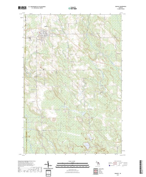
2023 Map of Onaway
USGS Topo · Published 2023About this map
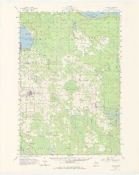
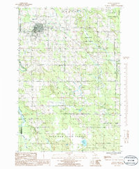
Onaway serves as the central hub for this portion of the northern Lower Peninsula, situated near the border of Cheboygan and Presque Isle counties. The town's grid is well-defined by streets like Elsden St and Tower St, while its community history is anchored by Elmwood Cem and St Paul's Catholic Cem. This region is a complex watershed where the Black River and Rainy River systems converge, characterized by numerous wetlands and the meandering paths of the Little Rainy River and Tomahawk Creek.
Find a feature on this map
75 named features on this map. Tap any name to fly to it.
Don’t see what you’re looking for? This feature index may not catch every label — zoom into the map to look around manually.
Map Details
Editions of this 2023 Onaway Map
This is the sole edition of this map. No revisions or reprints were ever made.
Historical Maps of Onaway Through Time
3 maps found