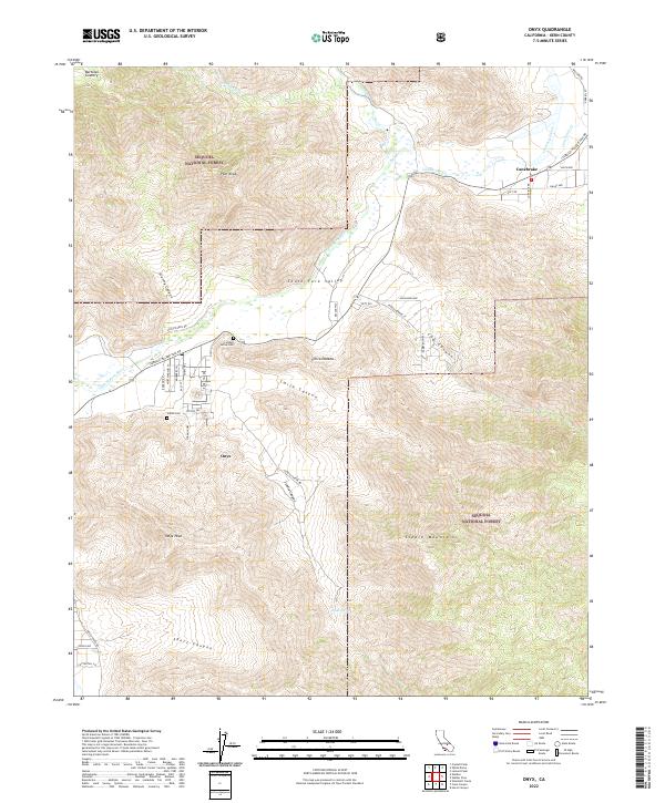
2022 Map of Onyx
USGS Topo · Published 2022About this map
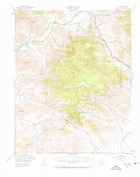
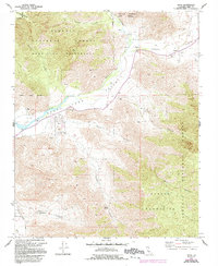
Onyx and the surrounding South Fork Valley are defined by the path of the S Fork Kern River as it cuts through the Scodie Mountains. This high-desert landscape in eastern Kern County shows a clear pattern of settlement hugging the narrow riparian corridor and road network, with cattle ranching roots evidenced by Doyle Ranch Rd. Family and community history is preserved at the Cottage Grove Cem and the Indian Cem, located near the base of Smith Canyon. To the north and west, the terrain rises sharply into the Sequoia National Forest, where landmarks like Pilot Knob overlook Bartolas Country. The map also details the remote community of Canebrake and the seasonal drainages of Stormy Canyon and Short Canyon that feed the river valley.
Find a feature on this map
48 named features on this map. Tap any name to fly to it.
Don’t see what you’re looking for? This feature index may not catch every label — zoom into the map to look around manually.
Map Details
Editions of this 2022 Onyx Map
This is the sole edition of this map. No revisions or reprints were ever made.