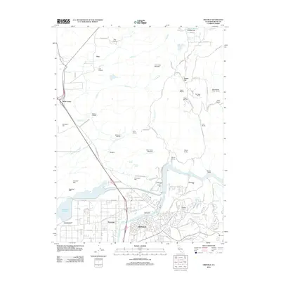
2012 Map of Oroville
USGS Topo · Published 2012About this map
The Feather River defines the southern reach of this 2012 survey, where the city of Oroville meets complex water management systems like the Thermalito Power Canal and the Lower Miocene Canal. North of the river, the landscape is shaped by the prominent basalt plateaus of North Table Mountain and South Table Mountain, which rise above a network of ravines and hollows including Morris Ravine and Beatson Hollow.
Find a feature on this map
86 named features on this map. Tap any name to fly to it.
Don’t see what you’re looking for? This feature index may not catch every label — zoom into the map to look around manually.
Map Details
Editions of this 2012 Oroville Map
This is the sole edition of this map. No revisions or reprints were ever made.
Other maps of this area

1888 · Marysville
USGS Topo · 1:125,000

1888 · Smartsville
USGS Topo · 1:125,000

1888 · Bidwell Bar
USGS Topo · 1:125,000

1891 · Bidwell Bar
USGS Topo · 1:125,000

1891 · Chico
USGS Topo · 1:125,000

1891 · Marysville
USGS Topo · 1:125,000

1891 · Smartsville
USGS Topo · 1:125,000

1892 · Smartsville
USGS Topo · 1:125,000

1893 · Chico
USGS Topo · 1:125,000

1893 · Bidwell Bar
USGS Topo · 1:125,000