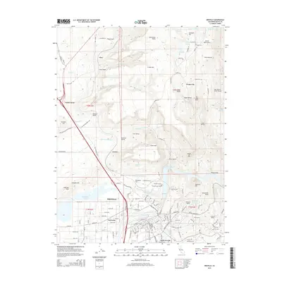
2015 Map of Oroville
USGS Topo · Published 2015About this map
Oroville anchors this landscape at the intersection of the Sacramento Valley and the western slopes of the Sierra Nevada. The Feather River serves as a central artery, flanked by the Thermalito Forebay and Thermalito Diversion Pool, illustrating a complex network of modern water management including the Lower Miocene Canal and Thermalito Power Canal. The map reveals a layering of early California settlement history through sites like Oregon City and the vanished presence of Monte de Oro, alongside long-established burial grounds such as Pioneer Cemetery and Thompson Flat Cemetery. Industry and infrastructure are evident in the Union Pacific rail lines and various ravines like Potter Ravine and Digger Ravine that cut through the plateaus. From N Table Mtn to the residential streets of South Oroville, this survey documents the transition from historical mining and pioneer outposts to a regional hub defined by hydroelectric power and valley agriculture.
Find a feature on this map
98 named features on this map. Tap any name to fly to it.
Don’t see what you’re looking for? This feature index may not catch every label — zoom into the map to look around manually.
Map Details
Editions of this 2015 Oroville Map
This is the sole edition of this map. No revisions or reprints were ever made.
Other maps of this area

1888 · Marysville
USGS Topo · 1:125,000

1888 · Smartsville
USGS Topo · 1:125,000

1888 · Bidwell Bar
USGS Topo · 1:125,000

1891 · Bidwell Bar
USGS Topo · 1:125,000

1891 · Chico
USGS Topo · 1:125,000

1891 · Marysville
USGS Topo · 1:125,000

1891 · Smartsville
USGS Topo · 1:125,000

1892 · Smartsville
USGS Topo · 1:125,000

1893 · Chico
USGS Topo · 1:125,000

1893 · Bidwell Bar
USGS Topo · 1:125,000