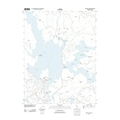
2012 Map of Oroville Dam
USGS Topo · Published 2012About this map
Lake Oroville dominates this Butte County landscape, its sprawling waters and intricate shoreline defined by the massive Oroville Dam. This modern survey illustrates the specialized infrastructure of the reservoir era, including the Lake Oroville Landing Area Seaplane Base and the Bidwell Bar Bridge spanning the complex fingers of the lake. The terrain is marked by numerous bars and ravines that reflect a history of hydraulic activity and mining, such as Montgomery Bar and Miller Bar. Residential and recreational developments like Kelly Ridge and the Kelly Ridge Golf Course sit perched above the water, while the Miners Ranch Tunnel and Miners Ranch Reservoir indicate the complex water management systems serving the region. To the south, Lake Wyandotte and Buffalo Ranch provide contrast to the massive scale of the primary reservoir.
Find a feature on this map
98 named features on this map. Tap any name to fly to it.
Don’t see what you’re looking for? This feature index may not catch every label — zoom into the map to look around manually.
Map Details
Editions of this 2012 Oroville Dam Map
This is the sole edition of this map. No revisions or reprints were ever made.
Other maps of this area

1888 · Marysville
USGS Topo · 1:125,000

1888 · Smartsville
USGS Topo · 1:125,000

1888 · Bidwell Bar
USGS Topo · 1:125,000

1891 · Bidwell Bar
USGS Topo · 1:125,000

1891 · Chico
USGS Topo · 1:125,000

1891 · Marysville
USGS Topo · 1:125,000

1891 · Smartsville
USGS Topo · 1:125,000

1892 · Smartsville
USGS Topo · 1:125,000

1893 · Chico
USGS Topo · 1:125,000

1893 · Bidwell Bar
USGS Topo · 1:125,000