2023 Map of Ostrander
USGS Topo · Published 2023About this map
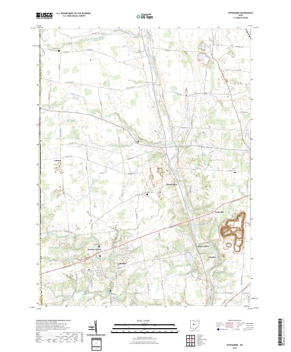
The Scioto River carves a prominent path through this western Delaware County landscape, flowing southward past the riverfront settlement of Warrensburg toward White Sulphur. The village of Ostrander serves as the inland hub of the quadrangle, situated at the intersection of Penn Rd and Marysville Rd. The geography is defined by a dense network of watercourses including Bokes Creek, Mill Creek, and Blues Creek, which dictated early settlement patterns and the placement of several small community clusters like Klondike and Fairview Corners.
Find a feature on this map
67 named features on this map. Tap any name to fly to it.
Don’t see what you’re looking for? This feature index may not catch every label — zoom into the map to look around manually.
Map Details
Editions of this 2023 Ostrander Map
This is the sole edition of this map. No revisions or reprints were ever made.
Historical Maps of Dover Township Through Time
Featured Locations
- Radnor Township, OH
- Concord Township, OH
- Delaware, OH
- Scioto, Scioto Township
- Ostrander, Scioto Township