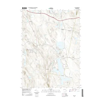
2015 Map of Otis
USGS Topo · Published 2015About this map
Otis Reservoir dominates this landscape, its waters broken by Gate Island and several points, providing a focal point for the surrounding Berkshire hill country. The village of Otis sits west of the reservoir, flanked by high ground such as The Pinnacle and Otis Ridge. The drainage of the West Branch Farmington River and the Fall River define the local valleys, where small settlements like Cold Spring and North Otis are connected by a network of local roads. Genealogy researchers will find interest in several local landmarks, including the Beech Plain Cem and West Center Cem. The area’s geography is further characterized by numerous small ponds and brooks, such as Larkum Pond and Dimmock Brook, reflecting the region’s glacial history and its legacy as a destination for seasonal and year-round residence near East Otis and Algerie Four Corners.
Find a feature on this map
114 named features on this map. Tap any name to fly to it.
Don’t see what you’re looking for? This feature index may not catch every label — zoom into the map to look around manually.
Map Details
Editions of this 2015 Otis Map
This is the sole edition of this map. No revisions or reprints were ever made.
Other maps of this area

1886 · Chesterfield
USGS Topo · 1:62,500

1886 · Becket
USGS Topo · 1:62,500

1887 · Granville
USGS Topo · 1:62,500

1888 · Becket
USGS Topo · 1:62,500

1888 · Sandisfield
USGS Topo · 1:62,500

1888 · Chesterfield
USGS Topo · 1:62,500

1889 · Granville
USGS Topo · 1:62,500

1893 · Granville
USGS Topo · 1:62,500

1893 · Chesterfield
USGS Topo · 1:62,500

1893 · Becket
USGS Topo · 1:62,500