2023 Map of Otsego
USGS Topo · Published 2023About this map
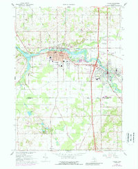
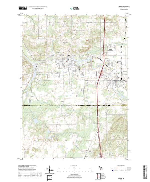
The Kalamazoo River and Gun River converge between the industrial and residential centers of Otsego and Plainwell in this modern topographic survey of southern Allegan County. This corridor is defined by its water-driven history, where Pine Creek and Sand Creek feed the larger river system. To the south, the terrain transitions at the Allegan Co Kalamazoo Co line, revealing a landscape dotted with kettle lakes such as Ruppert Lake, Hipps Lake, and Barbour Lake. Genealogists will find a high density of burial sites across the quadrangle, including the centrally located Mountain Home Cem and Saint Margaret Cem in Otsego, as well as Woodside Cem and Hillside Cem near Plainwell. The map also traces the distinct elevation of Millberg Ridge and provides a clear layout of the Plainwell Municipal Airport situated just north of the city center.
Find a feature on this map
91 named features on this map. Tap any name to fly to it.
Don’t see what you’re looking for? This feature index may not catch every label — zoom into the map to look around manually.
Map Details
Editions of this 2023 Otsego Map
This is the sole edition of this map. No revisions or reprints were ever made.