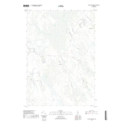
2018 Map of Otter Chain Ponds
USGS Topo · Published 2018About this map
Sunkhaze Meadows dominates the northern reaches of this landscape, where a dense network of water bodies like Little Buzzy Brook and Dudley Brook feed into the winding Sunkhaze Stream. In the southern half, the terrain rises toward Baker Hill and Haynes Ridge, interspersed with designated swamp lands including Number Sixteen Swamp and Number Twenty-six Swamp. The settlement pattern is concentrated in the southwest near the Evergreen Cem, where small roads like Boynton St and Cram St suggest a pocket of local development. This 2018 survey by the U.S. Geological Survey shows a wilderness used for both timber and recreation, evidenced by the named trail systems such as the Johnson Brook Trail and Oak Points Trail that weave through the woods and marshes.
Find a feature on this map
40 named features on this map. Tap any name to fly to it.
Don’t see what you’re looking for? This feature index may not catch every label — zoom into the map to look around manually.
Map Details
Editions of this 2018 Otter Chain Ponds Map
This is the sole edition of this map. No revisions or reprints were ever made.
Other maps of this area

1902 · Orono
USGS Topo · 1:62,500

1917 · Passadumkeag
USGS Topo · 1:62,500

1929 · Great Pond
USGS Topo · 1:48,000

1931 · Saponac
USGS Topo · 1:48,000

1932 · Great Pond
USGS Topo · 1:62,500

1934 · Saponac
USGS Topo · 1:62,500

1944 · Orono
USGS Topo · 1:62,500

1946 · Orono
USGS Topo · 1:62,500

1948 · Bangor
USGS Topo · 1:250,000

1954 · Millinocket
USGS Topo · 1:250,000