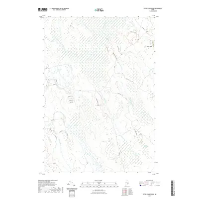
2021 Map of Otter Chain Ponds
USGS Topo · Published 2021About this map
Sunkhaze Meadows and a vast network of wetlands define this Maine landscape in Penobscot County. The area is characterized by an intricate drainage system where Sunkhaze Stream and Great Works Stream wind through low-lying terrain punctuated by landforms like Baker Hill and Haynes Ridge. This modern survey illustrates the persistence of the region's wilderness character, marked by numbered wetland tracts such as Number Sixteen Swamp and Number Thirty-two Swamp.
Find a feature on this map
40 named features on this map. Tap any name to fly to it.
Don’t see what you’re looking for? This feature index may not catch every label — zoom into the map to look around manually.
Map Details
Editions of this 2021 Otter Chain Ponds Map
This is the sole edition of this map. No revisions or reprints were ever made.
Other maps of this area

1902 · Orono
USGS Topo · 1:62,500

1917 · Passadumkeag
USGS Topo · 1:62,500

1929 · Great Pond
USGS Topo · 1:48,000

1931 · Saponac
USGS Topo · 1:48,000

1932 · Great Pond
USGS Topo · 1:62,500

1934 · Saponac
USGS Topo · 1:62,500

1944 · Orono
USGS Topo · 1:62,500

1946 · Orono
USGS Topo · 1:62,500

1948 · Bangor
USGS Topo · 1:250,000

1954 · Millinocket
USGS Topo · 1:250,000