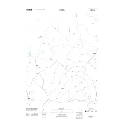
2013 Map of Overton
USGS Topo · Published 2013About this map
Sugar Ridge and a series of named summits dominate this high-plateau landscape in Bradford County. The area is defined by a network of rural crossroads and small settlements like Overton, Campbellville, and Estella. Many of these locations, such as Hugos Corners, Bedford Corners, and Vought Corners, preserve the names of early settler families, providing a clear footprint for genealogical research. The northern reaches are punctuated by Cahill Mountain and the Cahill Fire Tower, overlooking the drainages of Lick Cr and Mill Cr.
Find a feature on this map
89 named features on this map. Tap any name to fly to it.
Don’t see what you’re looking for? This feature index may not catch every label — zoom into the map to look around manually.
Map Details
Editions of this 2013 Overton Map
This is the sole edition of this map. No revisions or reprints were ever made.
Other maps of this area

1927 · Eagles Mere
USGS Topo · 1:48,000

1932 · Eagle Mere
USGS Topo · 1:62,500

1934 · Laporte
USGS Topo · 1:62,500

1943 · Monroeton
USGS Topo · 1:62,500

1943 · Powell
USGS Topo · 1:62,500

1945 · Powell
USGS Topo · 1:62,500

1953 · LaPorte
USGS Topo · 1:62,500

1953 · Eagles Mere
USGS Topo · 1:62,500

1954 · Williamsport
USGS Topo · 1:250,000

1960 · Williamsport
USGS Topo · 1:250,000
Featured Places
- Overton Township, PA
- Elkland Township, PA
- Forks Township, PA
- Monroe Township, PA
- Estella, Elkland Township