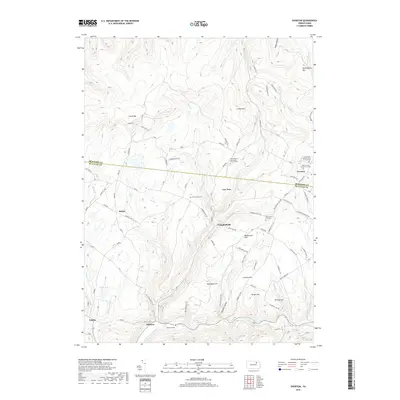
2019 Map of Overton
USGS Topo · Published 2019About this map
Overton and Estella anchor this rural landscape along the boundary of Bradford Co and Sullivan Co. The region is defined by a series of prominent rises such as Cahill Mtn, Warburton Hill, and Sugar Ridge, which separate the various tributaries feeding into the Little Loyalsock Creek. Small settlements like Campbellville and Millview are connected by a network of winding roads, including Campbellsville Rd and Dushore Overton Rd. For genealogists, the map is remarkably detailed regarding local burial sites, featuring the Saint Pauls United Church of Christ Cem, Saints Phillip and James Church Cem, and the Saint Francis Xavier Cem Cem. The presence of Estella Spr and Maple Lake further illustrates the water-rich geography of these highlands.
Find a feature on this map
84 named features on this map. Tap any name to fly to it.
Don’t see what you’re looking for? This feature index may not catch every label — zoom into the map to look around manually.
Map Details
Editions of this 2019 Overton Map
This is the sole edition of this map. No revisions or reprints were ever made.
Other maps of this area

1927 · Eagles Mere
USGS Topo · 1:48,000

1932 · Eagle Mere
USGS Topo · 1:62,500

1934 · Laporte
USGS Topo · 1:62,500

1943 · Monroeton
USGS Topo · 1:62,500

1943 · Powell
USGS Topo · 1:62,500

1945 · Powell
USGS Topo · 1:62,500

1953 · LaPorte
USGS Topo · 1:62,500

1953 · Eagles Mere
USGS Topo · 1:62,500

1954 · Williamsport
USGS Topo · 1:250,000

1960 · Williamsport
USGS Topo · 1:250,000
Featured Places
- Overton Township, PA
- Elkland Township, PA
- Forks Township, PA
- Monroe Township, PA
- Estella, Elkland Township