2021 Map of Oxly
USGS Topo · Published 2021About this map
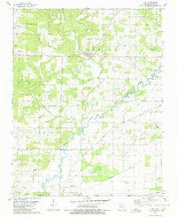
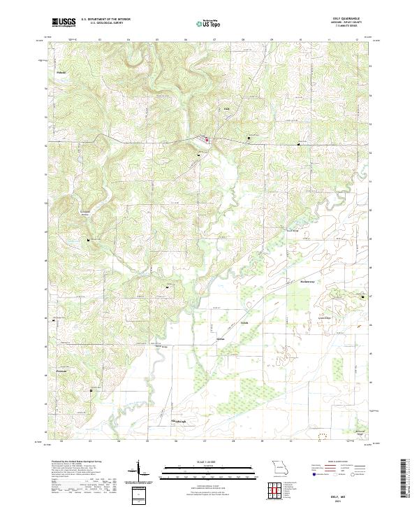
Oxly and the surrounding southern Missouri landscape are defined by the winding course of the Little Black River, which cuts through the low-lying terrain of Ripley County. This area reveals a pattern of rural settlement oriented around early crossings and family burials, with numerous landmarks such as Sewell Bridge and Bethel Bridge providing essential connections across the river and its tributaries like Harris Cr. Small community centers such as Pulaski, Hemenway, and Purman are scattered through the countryside, often anchored by local heritage sites.
Find a feature on this map
74 named features on this map. Tap any name to fly to it.
Don’t see what you’re looking for? This feature index may not catch every label — zoom into the map to look around manually.
Map Details
Editions of this 2021 Oxly Map
This is the sole edition of this map. No revisions or reprints were ever made.