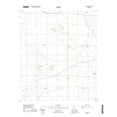
2020 Map of P O L Ranch
USGS Topo · Published 2020About this map
P O L Ranch sits along the western edge of this desert landscape in Doña Ana County, accessed by the winding Pol Ranch Rd. The terrain is defined by the volcanic features of the eastern Chihuahuan Desert, including the prominent volcanic formations of the Black Hills and the distant fringes of the West Potrillo Mountains. A small settlement at Eagle Nest provides a point of human reference amidst the vast public lands and grazing allotments that characterize this region. This modern survey illustrates the sparse but critical infrastructure of the high desert, where water management features like Black Hills Tank are essential for ranching operations. The map also delineates the boundary between Luna and Doña Ana counties, showing the geometric precision of the Public Land Survey System across the arid basin.
Find a feature on this map
13 named features on this map. Tap any name to fly to it.
Don’t see what you’re looking for? This feature index may not catch every label — zoom into the map to look around manually.
Map Details
Editions of this 2020 P O L Ranch Map
This is the sole edition of this map. No revisions or reprints were ever made.
Other maps of this area

1917 · Camel Mountain
USGS Topo · 1:62,500

1917 · Mt. Riley
USGS Topo · 1:62,500

1918 · Mt. Riley
USGS Topo · 1:62,500

1929 · Mt. Riley
USGS Topo · 1:62,500

1941 · Aden
USGS Topo · 1:62,500

1943 · Aden
USGS Topo · 1:62,500

1951 · Mt. Riley
USGS Topo · 1:62,500

1953 · El Paso
USGS Topo · 1:250,000

1955 · Las Cruces
USGS Topo · 1:250,000

1958 · Las Cruces
USGS Topo · 1:250,000