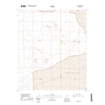
2023 Map of P O L Ranch
USGS Topo · Published 2023About this map
The high desert landscape where Luna and Doña Ana counties meet is defined by the volcanic topography of the West Potrillo Mountains. This modern topographic survey illustrates the transition between the arid plains and prominent elevations such as the Black Hills, located just north of the expansive Organ Mountains-Desert Peaks National Monument. The scarcity of water in this basin is reflected in the placement of isolated features like Black Hills Tank and the landmark known as Eagle Nest. Rural infrastructure is minimal, centered largely on the solitary Pol Ranch Rd which provides access through the southern reaches of the quadrangle. The map serves as a precise record of the current public land boundaries and township divisions across this part of the Chihuahuan Desert, where ranching heritage and federal conservation lands overlap.
Find a feature on this map
13 named features on this map. Tap any name to fly to it.
Don’t see what you’re looking for? This feature index may not catch every label — zoom into the map to look around manually.
Map Details
Editions of this 2023 P O L Ranch Map
This is the sole edition of this map. No revisions or reprints were ever made.
Other maps of this area

1917 · Camel Mountain
USGS Topo · 1:62,500

1917 · Mt. Riley
USGS Topo · 1:62,500

1918 · Mt. Riley
USGS Topo · 1:62,500

1929 · Mt. Riley
USGS Topo · 1:62,500

1941 · Aden
USGS Topo · 1:62,500

1943 · Aden
USGS Topo · 1:62,500

1951 · Mt. Riley
USGS Topo · 1:62,500

1953 · El Paso
USGS Topo · 1:250,000

1955 · Las Cruces
USGS Topo · 1:250,000

1958 · Las Cruces
USGS Topo · 1:250,000