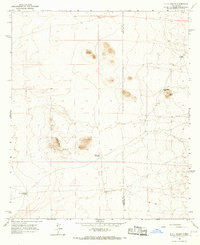
1965 Map of P O L Ranch
USGS Topo · Published 1967About this map
P O L Ranch sits near the southwestern edge of this Chihuahuan Desert landscape, situated along the border of Luna Co and Dona Ana Co. The map, based on 1964 aerial photography, reveals a region defined by water scarcity and cattle ranching. Scattered water sources such as Birchfield Well, Good Luck Well, and Eagle Nest Windmill are essential markers across the arid terrain. Natural landmarks like the prominent Eagle Nest and the nearby Prospect mine site offer insight into the local topography and small-scale exploration efforts of the mid-1960s. A network of Jeep Trails provides the primary means of navigating between these remote points, including the volcanic landforms of the Butte and the Black Hills to the east.
Find a feature on this map
12 named features on this map. Tap any name to fly to it.
Don’t see what you’re looking for? This feature index may not catch every label — zoom into the map to look around manually.
Map Details
Editions of this 1965 P O L Ranch Map
This is the sole edition of this map. No revisions or reprints were ever made.
Other maps of this area

1917 · Camel Mountain
USGS Topo · 1:62,500

1917 · Mt. Riley
USGS Topo · 1:62,500

1918 · Mt. Riley
USGS Topo · 1:62,500

1929 · Mt. Riley
USGS Topo · 1:62,500

1941 · Aden
USGS Topo · 1:62,500

1943 · Aden
USGS Topo · 1:62,500

1951 · Mt. Riley
USGS Topo · 1:62,500

1953 · El Paso
USGS Topo · 1:250,000

1955 · Las Cruces
USGS Topo · 1:250,000

1958 · Las Cruces
USGS Topo · 1:250,000