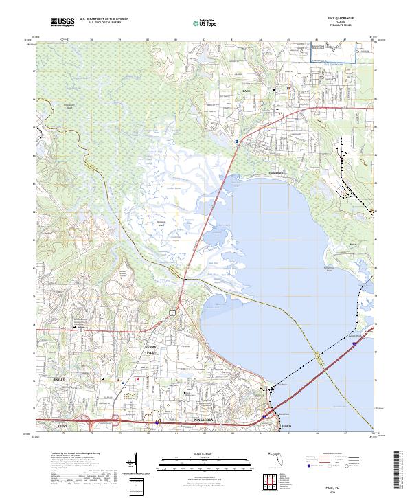
2024 Map of Pace
USGS Topo · Published 2024About this map
The Escambia River and its intricate delta systems, including Woodbine Bayou and Dead River, dominate this modern survey of the western Florida Panhandle. The landscape illustrates a complex transition from the educational campus of the University of West Florida to the military aviation operations at Spencer Naval Outlying Field. Along the eastern shores of the bay, the established communities of Pace and Floridatown contrast with the dense marshlands and numerous basins like Petermans Basin and Coulter Basin.
Find a feature on this map
87 named features on this map. Tap any name to fly to it.
Don’t see what you’re looking for? This feature index may not catch every label — zoom into the map to look around manually.
Map Details
Editions of this 2024 Pace Map
This is the sole edition of this map. No revisions or reprints were ever made.
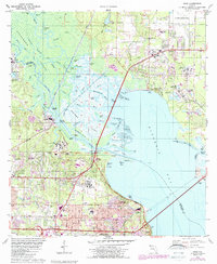
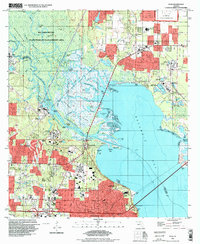
Historical Maps of Yniestra Through Time
3 maps found