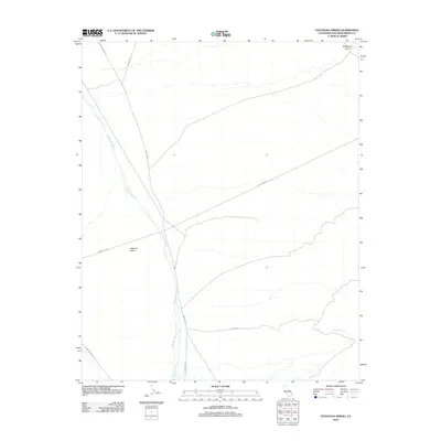
2012 Map of Pachalka Spring
USGS Topo · Published 2012About this map
Pachalka Spring serves as a critical water point in this arid stretch of the Mojave Desert, located within the expansive drainage of Kingston Wash. This 2012 survey illustrates the sparse but essential infrastructure of San Bernardino County, where deep desert valleys are defined by long-distance utility and mining corridors. Significant routes such as Excelsior Mine Rd and Kingston Rd intersect the landscape, providing access to remote industrial sites and mountain crossings. The northeastern corner is anchored by Mesquite Pass, a topographic break that has historically guided travel through the surrounding peaks. In the south, the broad expanse of Shadow Valley is crossed by Powerline Rd, reflecting the modern role of the desert as a corridor for regional energy distribution. For the researcher, this map records the exact positioning of desert tracks and springs in a landscape where reliable water and passage have remained constant priorities for over a century.
Find a feature on this map
10 named features on this map. Tap any name to fly to it.
Don’t see what you’re looking for? This feature index may not catch every label — zoom into the map to look around manually.
Map Details
Editions of this 2012 Pachalka Spring Map
This is the sole edition of this map. No revisions or reprints were ever made.
Other maps of this area

1910 · Ivanpah
USGS Topo · 1:250,000

1912 · Ivanpah
USGS Topo · 1:250,000

1942 · Ivanpah
USGS Topo · 1:250,000

1947 · Kingman
USGS Topo · 1:250,000

1948 · Kingman
USGS Topo · 1:250,000

1954 · Kingman
USGS Topo · 1:250,000

1955 · Kingman
USGS Topo · 1:250,000

1955 · Kingston Peak
USGS Topo · 1:62,500

1955 · Mescal Range
USGS Topo · 1:62,500

1956 · Halloran Spring
USGS Topo · 1:62,500