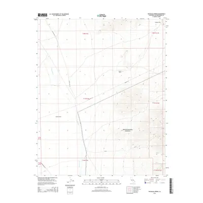
2015 Map of Pachalka Spring
USGS Topo · Published 2015About this map
Pachalka Spring serves as a critical water point in this arid stretch of the eastern Mojave Desert near the Nevada border. This 2015 survey details the intersection of high desert topography and essential infrastructure, where the protected lands of the Mojave National Preserve meet industrial corridors like Powerline Rd. The terrain is defined by the drainage of Kingston Wash and the broad expanse of Shadow Valley, providing a look at the desert landscape before it climbs toward Mesquite Pass. Several primitive routes, including Excelsior Mine Rd and Shadow Mountain Rd, trace the paths once used for regional mining and transport, offering modern researchers a clear record of the access points to this secluded portion of San Bernardino County.
Find a feature on this map
18 named features on this map. Tap any name to fly to it.
Don’t see what you’re looking for? This feature index may not catch every label — zoom into the map to look around manually.
Map Details
Editions of this 2015 Pachalka Spring Map
This is the sole edition of this map. No revisions or reprints were ever made.
Other maps of this area

1910 · Ivanpah
USGS Topo · 1:250,000

1912 · Ivanpah
USGS Topo · 1:250,000

1942 · Ivanpah
USGS Topo · 1:250,000

1947 · Kingman
USGS Topo · 1:250,000

1948 · Kingman
USGS Topo · 1:250,000

1954 · Kingman
USGS Topo · 1:250,000

1955 · Kingman
USGS Topo · 1:250,000

1955 · Kingston Peak
USGS Topo · 1:62,500

1955 · Mescal Range
USGS Topo · 1:62,500

1956 · Halloran Spring
USGS Topo · 1:62,500