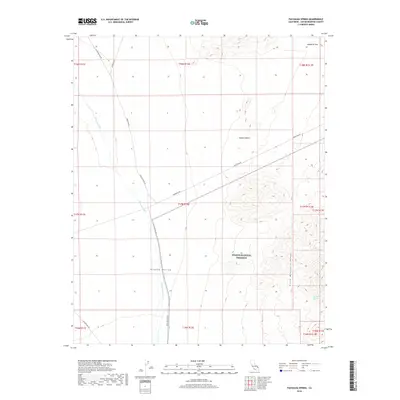
2018 Map of Pachalka Spring
USGS Topo · Published 2018About this map
Clark Mountain Range dominates the eastern landscape of this desert quadrangle, rising sharply above the expansive Mojave Desert floor. This 2018 survey documents a region defined by remote utility and mining access, where the prominent Excelsior Mine Rd and Kingston Rd bisect the arid plains. The presence of Pachalka Spring at the base of the mountains indicates a critical water point in an otherwise thirsty environment, a feature long significant to travelers and local fauna alike. Much of the southern and eastern territory is protected within the Mojave National Preserve, preserving the transition from the broad Shadow Valley to the steep heights of Mesquite Pass. The map also traces the seasonal drainage of Kingston Wash, showing how water occasionally moves across this high-desert basin through established channels.
Find a feature on this map
22 named features on this map. Tap any name to fly to it.
Don’t see what you’re looking for? This feature index may not catch every label — zoom into the map to look around manually.
Map Details
Editions of this 2018 Pachalka Spring Map
This is the sole edition of this map. No revisions or reprints were ever made.
Other maps of this area

1910 · Ivanpah
USGS Topo · 1:250,000

1912 · Ivanpah
USGS Topo · 1:250,000

1942 · Ivanpah
USGS Topo · 1:250,000

1947 · Kingman
USGS Topo · 1:250,000

1948 · Kingman
USGS Topo · 1:250,000

1954 · Kingman
USGS Topo · 1:250,000

1955 · Kingman
USGS Topo · 1:250,000

1955 · Kingston Peak
USGS Topo · 1:62,500

1955 · Mescal Range
USGS Topo · 1:62,500

1956 · Halloran Spring
USGS Topo · 1:62,500