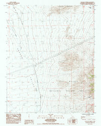
1985 Map of Pachalka Spring
USGS Topo · Published 1985About this map
Pachalka Spring serves as a vital water source in this high desert landscape, located where the Clark Mountain Range meets the vast expanse of the East Mojave National Scenic Area. The 1985 survey captures a transition point in land management and resource use, illustrating the intersection of natural features and human infrastructure. A prominent Transmission Line cuts across the northern desert floor of Shadow Valley, while the eastern portion of the map is dominated by the steep, rising contours of the Mesquite Mountains.
Find a feature on this map
17 named features on this map. Tap any name to fly to it.
Don’t see what you’re looking for? This feature index may not catch every label — zoom into the map to look around manually.
Map Details
Editions of this 1985 Pachalka Spring Map
This is the sole edition of this map. No revisions or reprints were ever made.
Other maps of this area

1910 · Ivanpah
USGS Topo · 1:250,000

1912 · Ivanpah
USGS Topo · 1:250,000

1942 · Ivanpah
USGS Topo · 1:250,000

1947 · Kingman
USGS Topo · 1:250,000

1948 · Kingman
USGS Topo · 1:250,000

1954 · Kingman
USGS Topo · 1:250,000

1955 · Kingman
USGS Topo · 1:250,000

1955 · Kingston Peak
USGS Topo · 1:62,500

1955 · Mescal Range
USGS Topo · 1:62,500

1956 · Halloran Spring
USGS Topo · 1:62,500