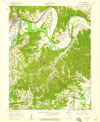
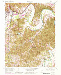
1954 Map of Pacific
USGS Topo · Published 1959About this map
Pacific sits at a critical junction of rail and river in the mid-1950s, where the Missouri Pacific and St Louis San Francisco railroads parallel the winding Meramec River. This survey reveals a landscape defined by sharp elevation changes and deep valleys, dotted with isolated religious and community institutions such as St Stephens Ch and Our Lady of Czestochowa Ch. The map captures the area before significant suburban expansion, highlighting the rural character of the Meramec township and its intricate network of creeks like La Barque Creek and McFall Creek. To the southeast, the small settlement of Byrnesville marks a crossing near the Big River, illustrating the importance of these waterways to the local topography and historical travel routes. Scattered landmarks like the St Josephs Hill Infirmary and Allenton Sch provide specific points of interest for genealogists tracing local family history.
Find a feature on this map
28 named features on this map. Tap any name to fly to it.
Don’t see what you’re looking for? This feature index may not catch every label — zoom into the map to look around manually.
Map Details
Editions of this 1954 Pacific Map
5 editions found
Other maps of this area

1901 · De Soto
USGS Topo · 1:125,000

1903 · O'Fallon
USGS Topo · 1:125,000

1930 · Pacific SE
USGS Topo · 1:24,000

1931 · Manchester SE
USGS Topo · 1:24,000

1931 · Pacific NE
USGS Topo · 1:24,000

1937 · Pacific
USGS Topo · 1:24,000

1938 · Cedar Hill
USGS Topo · 1:24,000

1940 · Cedar Hill
USGS Topo · 1:24,000

1940 · Eureka
USGS Topo · 1:24,000

1944 · Eureka
USGS Topo · 1:24,000