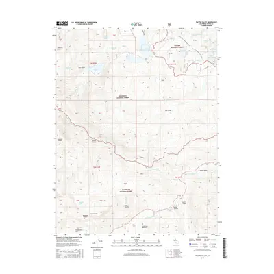
2015 Map of Pacific Valley
USGS Topo · Published 2015About this map
Toiyabe National Forest, Eldorado National Forest, and Stanislaus National Forest converge here, marking a significant high-altitude hydrologic divide. The N Fork Mokelumne River and the N Fork Stanislaus River originate in this alpine landscape, where steep canyons like Jackass Canyon and Jackson Canyon transition into high meadows. The presence of the Pacific Crest National Scenic Trail underscores the region's importance for long-distance travel through the Sierra Nevada. High-elevation valleys including Pacific Valley, Hermit Valley, and Clover Valley provide flat, seasonally wet terrain amidst the peaks. These meadows, such as Stanislaus Meadow and Cliff Meadow, historically served as vital waypoints and grazing lands. A dense network of alpine lakes, including Mosquito Lake, Wheeler Lake, and Tamarack Lake, feeds the headwaters of the major river systems descending toward the Central Valley.
Find a feature on this map
65 named features on this map. Tap any name to fly to it.
Don’t see what you’re looking for? This feature index may not catch every label — zoom into the map to look around manually.
Map Details
Editions of this 2015 Pacific Valley Map
This is the sole edition of this map. No revisions or reprints were ever made.
Other maps of this area

1889 · Pyramid Peak
USGS Topo · 1:125,000

1889 · Markleeville
USGS Topo · 1:125,000

1891 · Markleeville
USGS Topo · 1:125,000

1891 · Big Trees
USGS Topo · 1:125,000

1891 · Pyramid Peak
USGS Topo · 1:125,000

1893 · Markleeville
USGS Topo · 1:125,000

1894 · Big Trees
USGS Topo · 1:125,000

1895 · Pyramid Peak
USGS Topo · 1:125,000

1896 · Dardanelles
USGS Topo · 1:125,000

1896 · Pyramid Peak
USGS Topo · 1:125,000