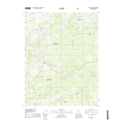
2018 Map of Pacific Valley
USGS Topo · Published 2018About this map
Pacific Valley and Hermit Valley anchor this High Sierra landscape within the converged borders of the Toiyabe National Forest, Eldorado National Forest, and Stanislaus National Forest. The map documents a high-altitude network of traditional and modern transit, featuring the historic Emigrant Trail alongside the Pacific Crest Trail. Water systems are central to the terrain, from the headwaters of the N Fork Mokelumne River and N Fork Stanislaus River to numerous alpine basins like Lower Blue Lake and Deadwood Lake. The elevation gains are represented by the steep Pacific Grade and the surrounding peaks overlooking Clover Valley and Sandy Meadow. Localized naming such as Jackass Canyon and Woodchuck Basin reflects the region's long history of seasonal grazing and exploration.
Find a feature on this map
57 named features on this map. Tap any name to fly to it.
Don’t see what you’re looking for? This feature index may not catch every label — zoom into the map to look around manually.
Map Details
Editions of this 2018 Pacific Valley Map
This is the sole edition of this map. No revisions or reprints were ever made.
Other maps of this area

1889 · Pyramid Peak
USGS Topo · 1:125,000

1889 · Markleeville
USGS Topo · 1:125,000

1891 · Markleeville
USGS Topo · 1:125,000

1891 · Big Trees
USGS Topo · 1:125,000

1891 · Pyramid Peak
USGS Topo · 1:125,000

1893 · Markleeville
USGS Topo · 1:125,000

1894 · Big Trees
USGS Topo · 1:125,000

1895 · Pyramid Peak
USGS Topo · 1:125,000

1896 · Dardanelles
USGS Topo · 1:125,000

1896 · Pyramid Peak
USGS Topo · 1:125,000