Loading...
Loading map...2022 Map of Padroni
USGS Topo · Published 2022About this map
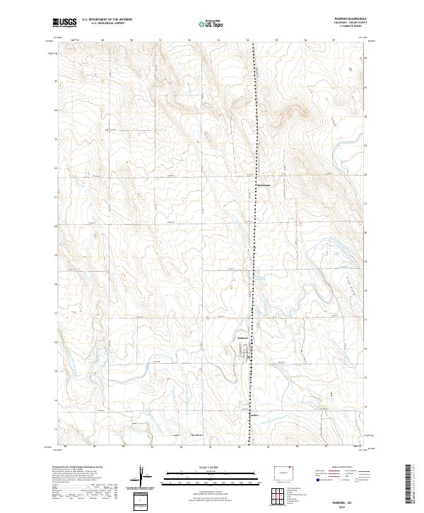
The settlement of Padroni serves as a focal point for this Logan County landscape, situated at the intersection of a grid-iron road network and a sophisticated irrigation system. The village is platted with distinct streets such as Cedar Ave, Sterling Ave, and Railroad Ave, reflecting its historical reliance on transportation and agriculture. Nearby, smaller named locations like Buchanan and Jessica dot the high plains, illustrating the dispersed nature of habitation in this region.
Find a feature on this map
37 named features on this map. Tap any name to fly to it.
Don’t see what you’re looking for? This feature index may not catch every label — zoom into the map to look around manually.
Map Details
Date Portrayed2022
Date Published2022
PublisherU.S. Geological Survey
Map TypeTopographic
Scale1:24000
Physical Dimensions24 x 29 inches
Editions of this 2022 Padroni Map
This is the sole edition of this map. No revisions or reprints were ever made.
Historical Maps of Padroni Through Time
Featured Locations
Source Details
SourceU.S. Geological Survey
CopyrightPublic Domain