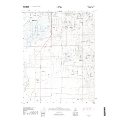
2018 Map of Palermo
USGS Topo · Published 2018About this map
The Oroville area in the Sacramento Valley shows a complex network of water management and suburban expansion as it appeared in the late 2010s. The Feather River defines the western edge of the city, feeding into the Western Canal, while the southern reaches are marked by the agricultural and residential transition at Palermo and Vista Robles. This landscape is characterized by its transportation and utility infrastructure, ranging from the Oroville Municipal Airport and the large Memorial Park Cem to the intricate grid of rural roads like Airport Pkwy and Larkin Rd. Genealogy researchers will find significant value in the detailed plotting of local burial grounds, including the Oroville Cem, and the established neighborhood of Oak Grove. The map also captures the seasonal drainages of the foothills, such as Wyandotte Cr and Wyman Ravine, illustrating how the valley floor meets the rising terrain of Butte County.
Find a feature on this map
105 named features on this map. Tap any name to fly to it.
Don’t see what you’re looking for? This feature index may not catch every label — zoom into the map to look around manually.
Map Details
Editions of this 2018 Palermo Map
This is the sole edition of this map. No revisions or reprints were ever made.
Other maps of this area

1888 · Marysville
USGS Topo · 1:125,000

1888 · Smartsville
USGS Topo · 1:125,000

1888 · Bidwell Bar
USGS Topo · 1:125,000

1891 · Bidwell Bar
USGS Topo · 1:125,000

1891 · Chico
USGS Topo · 1:125,000

1891 · Marysville
USGS Topo · 1:125,000

1891 · Smartsville
USGS Topo · 1:125,000

1892 · Smartsville
USGS Topo · 1:125,000

1893 · Chico
USGS Topo · 1:125,000

1893 · Bidwell Bar
USGS Topo · 1:125,000