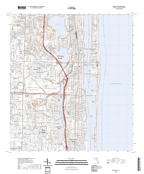
2024 Map of Palm Beach
USGS Topo · Published 2024About this map
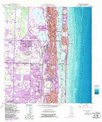
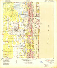
West Palm Beach and the barrier island of Palm Beach dominate this coastal landscape, separated by the Intracoastal Waterway and Lake Worth. The geography is defined by a dense network of residential communities and educational hubs, including Palm Beach Atlantic University and the Keiser University Residential Campus. The transition from the urban mainland to the Atlantic coast is marked by significant spans like the Flagler Memorial Brg and the Southern Blvd Brg, which connect to points of interest such as Everglades Island and Bingham Island.
Find a feature on this map
53 named features on this map. Tap any name to fly to it.
Don’t see what you’re looking for? This feature index may not catch every label — zoom into the map to look around manually.
Map Details
Editions of this 2024 Palm Beach Map
This is the sole edition of this map. No revisions or reprints were ever made.
Historical Maps of Palm Springs Through Time
3 maps found