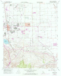
2021 Map of Palmdale
USGS Topo · Published 2021About this map
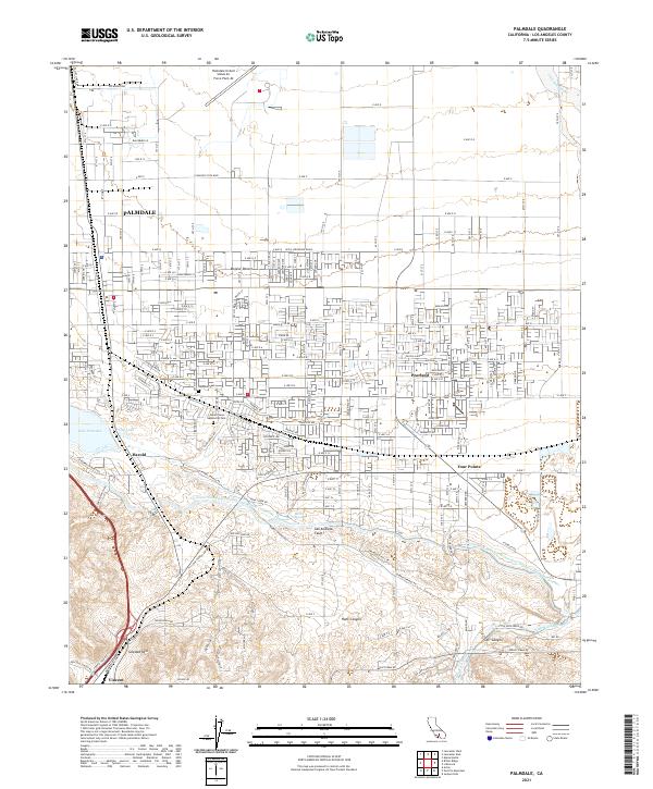
The Palmdale United States Air Force Plant 42 anchors the northern landscape of this High Desert corridor, illustrating the region's enduring ties to aerospace and defense. This 2021 study reveals a highly structured grid of residential expansion and industrial facilities, where the Mojave Desert meets the rising elevations of the Palmdale Hills. Significant infrastructure like the Governor Edmund G Brown East Branch California Aqueduct and the Little Rock Ditch trace the essential movement of water through this arid environment, while the visible line of the San Andreas Fault cuts a diagonal path across the southern half of the quadrangle.
Find a feature on this map
79 named features on this map. Tap any name to fly to it.
Don’t see what you’re looking for? This feature index may not catch every label — zoom into the map to look around manually.
Map Details
Editions of this 2021 Palmdale Map
This is the sole edition of this map. No revisions or reprints were ever made.
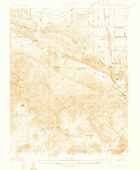
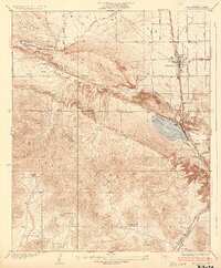
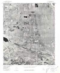
Historical Maps of Palmdale Through Time
5 maps found