2023 Map of Panama
USGS Topo · Published 2023About this map
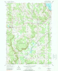
Panama Rocks dominates the local landscape near the village of Panama, where the headwaters of Little Brokenstraw Creek begin their southward descent. This 2023 survey illustrates a rural Chautauqua County landscape defined by small hamlets like Blockville, Watts Flats, and Niobe, which serve as quiet hubs for the surrounding agricultural tracts. The map reveals a dense concentration of historical burial sites, including the Blockville Union Burial Ground and the Tillotson Cem, providing a precise record for genealogists tracing local families.
Find a feature on this map
87 named features on this map. Tap any name to fly to it.
Don’t see what you’re looking for? This feature index may not catch every label — zoom into the map to look around manually.
Map Details
Editions of this 2023 Panama Map
This is the sole edition of this map. No revisions or reprints were ever made.