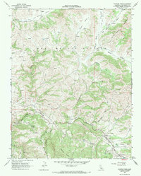
1968 Map of Panoche Pass
USGS Topo · Published 1971About this map
Panoche Pass serves as the focal point for this late 1960s survey of the California Coast Ranges, where the drainage systems of Tres Pinos Creek and Panoche Creek intersect. The terrain is defined by dramatic elevations such as Chemise Ridge and the Call Mountains, interspersed with high-country grazing lands like Dairy Flat and Lankford Flat. Evidence of early resource extraction and land management is visible at the Bradford Mine and the Antelope Fire Control Station, while the McCreery Ranch anchors the northern extent of Los Muertos Valley. The map details a complex network of canyons and ridges, including the Real De Las Aguilas and the winding course of Antelope Payne Valley Creek. A modern industrial layer is superimposed over this traditional ranching landscape in the form of multiple pipelines that traverse the southern reaches of the quadrangle.
Find a feature on this map
27 named features on this map. Tap any name to fly to it.
Don’t see what you’re looking for? This feature index may not catch every label — zoom into the map to look around manually.
Map Details
Editions of this 1968 Panoche Pass Map
This is the sole edition of this map. No revisions or reprints were ever made.
Other maps of this area

1913 · Panoche
USGS Topo · 1:125,000

1919 · San Benito
USGS Topo · 1:62,500

1922 · Quien Sabe
USGS Topo · 1:62,500

1931 · San Benito
USGS Topo · 1:62,500

1940 · Quien Sabe
USGS Topo · 1:62,500

1940 · San Benito
USGS Topo · 1:62,500

1943 · Ortigalita Peak
USGS Topo · 1:62,500

1944 · Panoche Valley
USGS Topo · 1:62,500

1948 · Santa Cruz
USGS Topo · 1:250,000

1955 · Santa Cruz
USGS Topo · 1:250,000