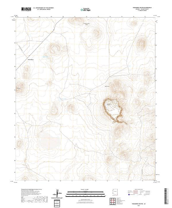
2021 Map of Paramore Crater
USGS Topo · Published 2021About this map
Paramore Crater and the wide desert expanses of the San Bernardino Valley define this portion of Cochise County. The topography is marked by volcanic landforms and drainage patterns such as Black Draw, which cuts through the arid landscape toward the southern border. Near the northwestern corner, the settlement of Chiricahua sits along the historic transportation corridor, supported by water infrastructure like the Chiricahua Siding Tank.
Find a feature on this map
15 named features on this map. Tap any name to fly to it.
Don’t see what you’re looking for? This feature index may not catch every label — zoom into the map to look around manually.
Map Details
Editions of this 2021 Paramore Crater Map
This is the sole edition of this map. No revisions or reprints were ever made.
Other maps of this area

1917 · Chiricahua
USGS Topo · 1:125,000

1919 · Perilla
USGS Topo · 1:125,000

1919 · Chiricahua
USGS Topo · 1:125,000

1922 · McDonald
USGS Topo · 1:62,500

1926 · Pedregosa
USGS Topo · 1:62,500

1940 · Apache
USGS Topo · 1:62,500

1940 · College Peaks
USGS Topo · 1:62,500

1955 · Douglas
USGS Topo · 1:250,000

1958 · Apache
USGS Topo · 1:62,500

1958 · Guadalupe Canyon
USGS Topo · 1:62,500