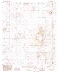
1987 Map of Paramore Crater
USGS Topo · Published 1987About this map
Paramore Crater sits as a prominent volcanic feature in the high desert of Cochise County, anchoring a landscape shaped by both geology and historical transport. This mid-1980s record captures a wide expanse of the San Bernardino Valley, where the terrain is marked by intermittent water features like Malpais Tank and the seasonal basins of Dry Lake. A clear linear trace of the Old Railroad Grade runs through the western portion of the map, passing near the settlement area of Chiricahua. The map illustrates a ranching and transit landscape where cattle corrals and water draws like Black Draw are the primary landmarks. The presence of the abandoned rail alignment alongside volcanic landmarks like Red Hill provides a detailed look at the infrastructure of the Arizona borderlands before modern developments altered the local character.
Find a feature on this map
12 named features on this map. Tap any name to fly to it.
Don’t see what you’re looking for? This feature index may not catch every label — zoom into the map to look around manually.
Map Details
Editions of this 1987 Paramore Crater Map
This is the sole edition of this map. No revisions or reprints were ever made.
Other maps of this area

1917 · Chiricahua
USGS Topo · 1:125,000

1919 · Perilla
USGS Topo · 1:125,000

1919 · Chiricahua
USGS Topo · 1:125,000

1922 · McDonald
USGS Topo · 1:62,500

1926 · Pedregosa
USGS Topo · 1:62,500

1940 · Apache
USGS Topo · 1:62,500

1940 · College Peaks
USGS Topo · 1:62,500

1955 · Douglas
USGS Topo · 1:250,000

1958 · Apache
USGS Topo · 1:62,500

1958 · Guadalupe Canyon
USGS Topo · 1:62,500