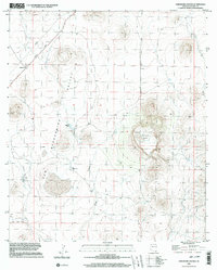
1996 Map of Paramore Crater
USGS Topo · Published 2003About this map
Paramore Crater stands as the central landmark of this corner of Cochise County, anchoring a terrain defined by volcanic features and the open expanse of the San Bernardino Valley. The map documents a landscape where traditional ranching infrastructure, such as Corral, Malpais Tank, and numerous water tanks, meets the industrial remnants of earlier transit. The diagonal path of the Old Railroad Grade and an adjacent Pipeline trace the historic movement of resources through this arid environment. The intermittent course of Black Draw winds through the southern portion of the quadrangle, illustrating the drainage patterns that have shaped the valley floor. Near the northern boundary, the settlement of Chiricahua sits along the roadway, marking a point of human activity in an otherwise sparse, topography-heavy region.
Find a feature on this map
10 named features on this map. Tap any name to fly to it.
Don’t see what you’re looking for? This feature index may not catch every label — zoom into the map to look around manually.
Map Details
Editions of this 1996 Paramore Crater Map
This is the sole edition of this map. No revisions or reprints were ever made.
Other maps of this area

1917 · Chiricahua
USGS Topo · 1:125,000

1919 · Perilla
USGS Topo · 1:125,000

1919 · Chiricahua
USGS Topo · 1:125,000

1922 · McDonald
USGS Topo · 1:62,500

1926 · Pedregosa
USGS Topo · 1:62,500

1940 · Apache
USGS Topo · 1:62,500

1940 · College Peaks
USGS Topo · 1:62,500

1955 · Douglas
USGS Topo · 1:250,000

1958 · Apache
USGS Topo · 1:62,500

1958 · Guadalupe Canyon
USGS Topo · 1:62,500